Eastern Europe
Exploring the Hidden Europe in 2004 and 2008-2011
In 2004, I visited all 25 countries in Eastern Europe. You'll find the blog entries from that trip here. In 2008-2011, I returned to see what had changed since that time. With these two visits, five years apart, I accumulated enough material for my 750-page book, The Hidden Europe: What Eastern Europeans Can Teach Us.
This blog now has many excerpts from The Hidden Europe. But who the hell reads anymore? Just look at the best photos from Eastern Europe!
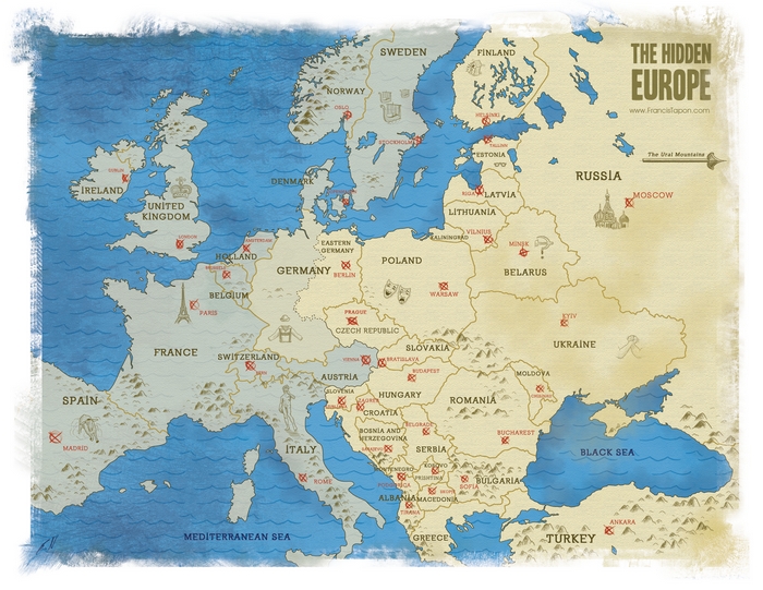
This map reflects how I define Eastern Europe. Eastern Europeans love to deny that they're in Eastern Europe. I tackle how and why I define Eastern Europe the way I do in the Introduction of The Hidden Europe.
Where to go in Northern Greece
Places I saw and recommend in Northern Greece: Metéora. I’m sure it’s fun to climb Mt. Olympus, but I was too busy having fun in Thessaloniki.
Is Greece in Eastern or Western Europe?
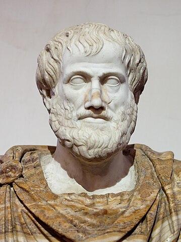 Whenever you think of the founder of western civilization, you probably think of Greece:
- The Greeks gave us Homer's epic poems, the Corinthian columns that are everywhere, and an early version of democracy.
- Just the names of Greek places conjure up wondrous images: Athens, Thebes, Sparta, Crete, Rhodes, Mount Olympus, and the Aegean Sea.
- Western companies use the names of Greek gods and heroes: Zeus, Athena, Poseidon, Hermes, Apollo, Perseus, Hercules, and of course, Nike.
- Western literature and ideas were born out of text written in Greek such as The Iliad, The Odyssey, Oedipus, Medea, and the Bible's New Testament.
- Western heroes include Greeks like Plato, Socrates, Aristotle, Thucydides, Herodotus, Euripides, Archimedes, and countless others.
- Greeks built much of our foundation in mathematics, medicine, science, and philosophy.
The astronomer Carl Sagan observed that if the repressive Middle Ages had not come and Europe had stayed on the technological path that the Greeks had started us on, then we would have colonized the Solar System by now.
Given that everyone associates Greece with western culture and civilization, it's ironic that Greece is in Eastern Europe. [I'm assuming a binary east-west split, where the idea of "southern Europe" doesn't exist. For more about this read about how I define Eastern Europe.]
Americans don't like looking at maps, so it's easy to forget that Greece's northern borders touch the Eastern European countries of Albania, Macedonia, and Bulgaria. In fact, Greece is so far east in Europe that you only have to drive two hours east from the Greek border and you'll have left the European continent and entered Asia! Istanbul, the gateway to Asia, is short drive away (see map below).
Hence, geographically, it's obvious that Greece is in Eastern Europe. Just don't tell the Greeks that, it will piss them off.
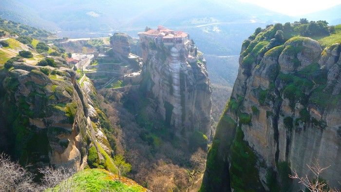
If you were looking for evidence that Hades, the Greek god of the underworld, was trying to claw his way to our plane of existence, it's in Metéora. It seems as if his stony fingers are piercing through the earth's flesh and reaching toward Zeus in defiance. In Greek, Metéora means suspended rocks. About 60 million years ago (five million years after the dinosaurs went bye-bye), Metéora's sandstone pinnacles formed. Weather carved them into their shape today. They may remind you of Monument Valley in Utah. What makes Metéora truly special is that hundreds of years ago Greeks built celestial monasteries on top of these rocks. When you see them, you'll ask yourself, "How the hell did they build that there?"
Where to go in Macedonia
Places I saw and recommend in Macedonia: Skopje and Lake Ohrid.
Defining Macedonia
If you’re like most people on this planet, you know almost nothing about Macedonia. Incredibly, for over 20 years, Greece and Macedonia have been passionately and fanatically fighting each other over Macedonia’s name. It sounds absurd (and it is), but it’s true. Welcome to the Balkans.

Places I saw and recommend in Kosovo: Prizren and the mountains near the Albanian border.
How Serbia is similar to Oklahoma
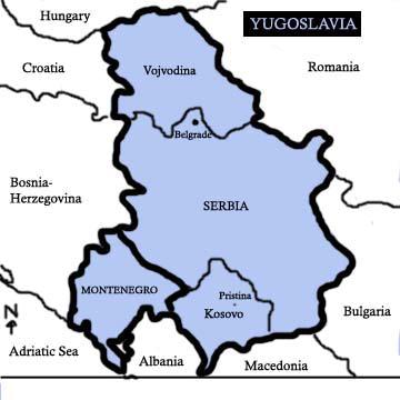 In 1974, Serbia became like Oklahoma. Most Yugoslavs were not happy with the centralized economy and they thought decentralization would fix things. To avoid a revolt, Tito agreed to increase everyone's autonomy. Among the five republics, Serbia was the only one to have two autonomous provinces carved out of it: Vojvodina in the north and Kosovo in the south. Albanians were begging Tito for republic status, but Tito picked the compromise solution: autonomy. As a result, Serbia turned into Oklahoma.
Oklahoma, along with several other western US states, has large Native American reservations within it. Although the US has 50 states, there are about 310 autonomous Indian reservations within them.
In the map below highights the autonomous Indian reservations. Oklahoma is the state in the middle with blue colored reservations representing the Cherokee Nation. Mouse over the image to zoom in. Or view the high resolution version.
- Albania
- Montenegro
- Bosnia
- Three Sights to See in Prague
- Serbia
- Croatia
- Slovenia
- Hungary
- Slovakia
- Czechia
- Eastern Germany
- Poland
- Belarus
- Lithuania
- Latvia
- Finland
- Counting to 10 in Estonian and four other languages
- Finland: home to the smartest kids in the world
- 10 facts about Estonia that you may not know
- Best photos
Your comment will be deleted if:
- It doesn't add value. (So don't just say, "Nice post!")
- You use a fake name, like "Cheap Hotels."
- You embed a self-serving link in your comment.
