10 steps on how to do a contiguous CDT thru-hike via the Grand Teton National Park.
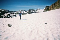
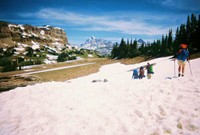
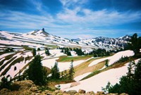
First, realize that you'll be missing the Parting of the Waters. Although this is a pity, it's worth doing this alternate route through the Tetons to sneak in an extra National Park in the journey! Although the Parting of the Waters is great, the Grand Tetons blows it away!
The instructions below assume that you are northbound. Buy the National Geographic Trails Illustrated map and follow these 10 steps:
- At the Green River in the Wind River Range, break away from the trail and head west into the Gros Ventre Wilderness.
- There are many paths you can take, but try to pick one that drops you into Jackson, Wyoming. The Cache Creek Trail #3003 and the West Game Creek Trail #3025 both drop you into Jackson. If you prefer resupplying in Wilson (which is on the way), you can avoid Jackson by going over Snow King Mountain).
- Road walk from Jackson to Wilson via Hwy 22 (about 5 miles).
- When you get to Wilson, I recommend taking the road north for 4 miles, and then you'll get to trail #3001 (Phillips Canyon). Another option is to stay on Hwy 22 for another 4 miles west of Wilson and then grab the trail there which goes north into the Phillips Ridge.
- Stay north following the Teton Crest Trail.
- Pass Sunset Lake in the Alaska Basin and go over Hurricane Pass.
- Pass the Grand Teton and head to Lake Solitude.
- At Lake Solitude, bushwhack northwest for 3 miles (so you get on the crest) and then drop into the Granite Basin, where a find a nice trail that heads north, and eventually go over Jackass Pass.
- Follow the Berry Creek Trail until you get to Grassy Lake Road.
- Once you get to the highway, near Flagg Ranch, you will have a couple of ways to enter into Yellowstone National Park.
Have fun!
Trail Journal
I've backpacked almost 2,000 miles, nearly the length of the Appalachian Trail, and I have yet to bump into a single backpacker. Not one for 2.5 months.
In New Mexico I saw one day hiker with a dog. In Colorado I met two snowmobilers (in the San Juans) and two skiers (in the Rocky Mt. Nat'l Park). Nobody in Wyoming, so far.
However, now that I'm entering the Grand Teton National Park, I expect to find a few mountaineers who will pull out their cell phones and place the all important victory call.
Breaking the camera... again!
I was planning to climb take a detour off the Continental Divide Trail, head towards the real Divide, and summit the tallest mountain in Wyoming (Gannett Peak). It's 13,800 feet high and a mountain guide told me, "I wouldn't do it without crampons, an ice axe, and a strong partner."
Great, I have none of the above, unless you count my Guardian Angel.
I decided to go for it anyway. I was pushing through the snow at 11,000 feet when I saw a beautiful frozen lake. I placed my camera on a rock and set the timer. As I started to move to get into the picture, the camera started to fall toward a puddle of water. I lunged and grabbed the camera forcefully. A bit too forcefully...
I put too much pressure on the extended lens, jamming it against the rock. The mechanism broke so I was, once again, camera-less. The timing was horrible. It was a beautiful day - a perfect day to summit Gannett Peak. A perfect day to trek across glaciers with hidden crevasses. A perfect day to traverse the Continental Divide, camp above the tree line, and freeze your ass off. A perfect day to die, but get some good photos in the process.
After much thought, I concluded that there's little point in dying on a mountain if you don't leave a few cool pictures behind.
I backed down and resolved to visit Gannett Peak on my southbound journey in August. By then the crevasses should be wide open and thunderstorms will be booming away! Sweet!
Mr. Magoo luck, part 1
Instead of following the Divide, I followed the CDT which goes along the Green River in the Wind River Wilderness. That path takes you through the most beautiful valley I have seen on the CDT. It has granite monoliths that rival the ones in Yosemite Valley and the only way to see it is by walking there. I lamented that I didn't have a camera to take a few amateurish shots.
Just as I was exiting the valley, I saw a digital camera lying on a rock. Clearly, someone lost it. I'm not sure how long it was lying there, but I was amazed that it worked. I took a few amateurish shots.
Mr. Magoo luck, part 2
The second lucky break was when I was traversing the Gros Ventre Wilderness. I was breaking away from the CDT to get to Grand Teton National Park. The CDT doesn't go there, but I want to hike through it on my way to Canada. I'll take the CDT on the way back. However, getting to the Tetons would be tricky since I didn't have a detailed map of the Gros Ventre Wilderness. I just had a state map, which would make the typical outdoorsman laugh so hard that he would have to hold onto his gros ventre (means "fat belly" in French).
I resolved to hike west and climb over any mountain in my way. However, as I walking up a forest service road, a truck was coming down. The driver was surprised to see me in this deserted place. He confirmed that I was going the right way. Realizing that I was attempting a 50 mile traverse without a decent map, he took pity on me and gave me his map.
I was lucky to have a map and I had no trouble getting to the Tetons! The weather is perfect too!
Sponsor spotlight: GoLite
GoLite has been supporting my adventures since 2001 and I'm quite grateful. They're a responsible company that makes extraordinary outdoor gear. On this trip they're making sure I don't run around naked. Here's what I am using:
- Ether Wind Jacket: At 3.5 ounces, the Ether name is accurate. It protects me from bugs and the wind.
- Whim Pants: I can't believe how tough these 4 oz pants are. I've bushwhacked through so much thorny brush in New Mexico, slogged through icy snow in Colorado, and press through most of Wyoming, yet it just has a few small holes. It's crazy. And it's crazy light too.
- DriMove Shirt: It's made of recycled materials, provides 50 SPF, dries fast, and weighs nearly nothing.
- Stride Shorts: Made of Lycra and nylon, they're similar to biker shorts, without the funny butt pad. I have yet to have any chafing problems, so that makes me smile.
- Chrome Dome Umbrella: GoLite redesigned it for 2007 and it weighs over 20% less than the previous model. It's just 8 oz and allows me to carry less water and sunscreen on those hot days. Oh, and it's waterproof too! :)
Please visit: www.GoLite.com


