Go south, young man
Why is it that on a typical year over 90 percent of PCT thru-hikers head northbound?
While we were gorging at the all-you-can-eat breakfast at Mt. Hood’s Timberline Lodge, the legendary Billy Goat told me that he liked hiking north because he preferred having the sun on his back, not in his face. I didn’t expect that answer.
The usual reasons thru-hikers give is that they want company, or they like to follow tradition, or they love the idea of finishing in British Columbia. One funny Canadian said that he was heading north because he figured that walking was the cheapest way to get back home.
However, thru-hikers are an independent and defiant lot, so it’s curious that nearly everyone goes the same way. You would expect thru-hikers to buck an existing trend just like some of them don’t conform to society’s traditional expectations. The thru-hiker mantra: “Showers? We don’t need no stinkin’ showers!”
This leads most to conclude that the main reason over 90 percent of thru-hikers are Northbounders (Nobos) is that it’s easier to head north than south. At first glance, this makes sense. As a Southbounder (Sobo) I faced massive challenges. For example, Sobos:
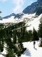
- Start in deep snow which covers a few hundred miles in Washington (our snow didn’t let up until we got south of the Goat Rocks, halfway down the state).
- Have to climb up snowy north faces and climb down dry south faces; Nobos do the opposite, which is easier.
- Must navigate extremely well because there are no footprints or tree markings to follow (like the Sierra has in June).
- Face extreme isolation (we didn’t see anyone hiking our direction until we got to the middle of Oregon—and they were just out for the weekend).
- Need to read the guidebook backwards since it’s written from Nobos; it’s easy to make errors when “left” means “right” and “ascend” means “descend.”
- Have less daylight than Nobos, who enjoy the summer solstice in the middle of their journey; Sobos start around June 21 and lose daylight immediately.
- Must rush to get out of the Sierra by the first week of October or risk snowstorms.
- Encounter the California desert in the fall, when the water availability is at its lowest point of the year and caches are not reliable.
In conclusion, going southbound on the PCT seems tougher than heading northbound. Ray Jardine, who thru-hiked the PCT in both directions, said that the southbound hike was definitely harder than the northbound one. Chris Townsend, a legendary backpacker, agreed. However, upon closer examination this conventional wisdom may not apply to everyone.
The thru-hiking window: What’s interesting about the PCT is that both Nobos and Sobos have about 3.5 months to walk the 2,000 miles between Kennedy Meadows and Manning Park. Nobos generally want to leave Kennedy Meadows around June 15 and arrive in Canada by October 1. Sobos rarely leave Canada before June 15 and aim to be at Kennedy Meadows by October 1. Of course it’s possible to push these dates out a month in either direction depending on your skills and conditions, but these are the generally accepted dates for a relatively comfortable three-season thru-hike. Yes, macho backpackers who prefer winter traverses would snap me like a twig for suggesting such a narrow hiking window. However, unless you cherish building snow caves, let’s agree that Nobos and Sobos have basically the same amount of time to cover those 2,000 miles.
The Nobo Benefit: The Nobos benefit greatly from a 700-mile warm up on their way to Kennedy Meadows. Southern California lets Nobos shake out their gear and build their hiking legs. Since the clock doesn’t start ticking until June 15, Nobos can start as early as March to give themselves plenty of time to adjust to life under a flimsy tarp.
The Sobo Challenge: Sobos, on the other hand, have no such luxury. They have to hit the ground running. The clock starts ticking for them the moment they set foot in Canada. The pressure to move continues until they get to Kennedy Meadows. Furthermore, the benefit of doing big miles continues even after Kennedy Meadows because the water sources south of there are more spaced out than for the Nobos, especially if you’re hiking in November. The Forest Service shuts off many water faucets after November 1 because the pipes will freeze. This compels the Sobo to thru-hike the trail in 4.5 months or less. Or be really thirsty.
Snow: For years I would backpack in the Sierra every May. Therefore, I have a good idea of the swollen rivers and the snow conditions that Nobos face in June and July. Washington in June is comparable, even though the PCT’s altitude is nearly half that of the Sierra; Washington’s latitude and heavy precipitation makes up for it. Therefore, all PCT thru-hikers have to deal with snow. The only difference is that the Sobo has greater navigation challenges while the Nobo has slightly harder river crossings.
So far, we’ve focused on the downsides of going Sobo; now let’s consider the upsides.
When Southbound is Easier Than Northbound: What if you plan to thru-hike the PCT in less than 4.5 months? Some have constraints that force them to hike at a certain pace. In Oregon ,I met an airline pilot in his 50s who had limited time off and needed to thru-hike the PCT in 100 days. Although he did it, he probably would have had a better time going south.
If you’re good at navigating and can keep up an above average pace, then heading south is more pleasant than going north. A speedy Nobo waits until May to leave Campo. As a result, she deals with a blazing desert filled with rattlesnakes, empty water caches, a snow covered Sierra with tough fords, lots of bugs, and rainstorms in Washington.
The speedy Sobo, on the other hand, has a sunny, but snowy Washington, encounters few bugs, deals with only a couple of river crossings, waltzes through the Sierra in its prime, and enjoys a cool desert with few snakes.
4.5 month PCT thru-hike comparison
This table assumes a 4.5 month pace and shows when the thru-hiker would arrive in each section and what to expect.
|
|
Speedy Nobo |
Speedy Sobo |
|
Southern CA |
Mid-May: An inferno with few springs, dwindling water caches, and prevalent snakes. |
October: A cool desert with enough water and few snakes. |
|
Sierra Nevada |
Mid-June: Snow covered, navigation issues, tricky creek crossings, hordes of bugs! |
September: Few hikers, no bugs or snow, easy crossings, stable weather. |
|
Northern CA |
July: Hot! |
August: Warm. |
|
Oregon |
August: Few bugs. |
Late July: Some bugs. |
|
Washington |
September: Cold, rainy weather. |
Late June/July: Snow, but warm sunny weather, few bugs. |
Little Rain: A Sobo usually encounters less rain than a Nobo. Having lived in Washington a couple of years, I can testify that June’s weather is generally more sunny and calm than August or September. Because the skies in Washington are so clear in June it’s relatively easy to navigate through the snow because you can identify far away landmarks. We didn’t carry any rain gear for the entire state of Washington! I certainly don’t advise leaving your rain gear behind, but we received one hour of rain during our month there. We got one hour of rain in Oregon and one hour in the Northern California (including the Sierra). The most rain we received (about seven hours of drizzle) was, ironically, in the desert of Southern California in October. Therefore, we had 10 hours of rain for the entire trail! The typical Nobo can get that much in one day in Washington.
Few Bugs and a Clear Sierra: We dealt with bugs only a couple of nights on the PCT and never had more than a dozen buzzing around. Meanwhile, Nobos described “sheets” of mosquitoes at the end of June. After Labor Day the Sierra has few people, no snow, and no bugs; all this makes for pleasant hiking. We hiked the 240 miles from Tuolumne Meadows to Kennedy Meadows in nine days and without any resupply; this is unthinkable for Nobos.
Cool Desert: By the time a Sobo gets to Southern California, 700 miles seems like a cakewalk especially since the temperatures in October are cool. Armed with an umbrella, sweat dripped down my brow only once. The cool October temps allow you to get by with less water than you’d need during the May inferno. Although water sources are a bit more spaced out than in May, the chilly weather helps you cover those distances with moderate amounts of water. The toughest stretch for us was a 50-mile stretch without getting water, but we only did that because we didn’t have a purification method at the time and we wanted to see if we could break our backs with 20 liters of water.
Environmental Benefit: When 300 hikers start in the fragile desert less than a month apart, it can strain the ecosystem even when everyone is practicing leave no trace principles. Ben Schifrin, co-author of the Official PCT Guidebook, told me when we hiked a couple of hours together in Oregon, “There’s a big difference between 50 people walking across your lawn over 50 days versus 50 people walking over it on one day.”
By starting in Canada, Sobos spread out the environmental impact that thru-hikers make, giving nature more time to recuperate. If half the thru-hikers were Sobos we’d minimize the impact long distance hikers have on the PCT. Flip floppers and section hikers can also consider hiking during off-peak times. Lastly, generous Trail Angels, post offices, and small businesses also don't want a herd of thru-hikers to overrun them; they would rather see them spaced out over the hiking season.
Want to set a new PCT speed record? Because of the advantages of the Sobo hike, I predict that whoever wants to set a new PCT thru-hiking speed record will go south. This psycho hiker will leave around August 1 after the snow melts in Washington and will walk like a lunatic for two months, finishing in early October, thereby avoiding the snow and heat that plague those who sprint north.
If such an insane pace doesn’t appeal to you, but you want/need to go faster than 4.5 months, then aim to finish in October and work backwards to determine the appropriate start date. For example, we started June 23 and finished October 21, just under 4 months.
Conclusion: When we bumped into Scott Williamson during his 2006 yo-yo of the PCT, he thought more people should go southbound because it’s “easier” than northbound. He thought the reason more didn’t do it is that they’re “scared.” Indeed, the journey of the Sobo is mysterious and maybe even daunting because few have done it and documented it. I hope this article lifts the veil of the Sobo hike and encourages others to see its benefits.
In short, a southbound thru-hike can be easier than a northbound one, especially if you enjoy solitude, navigate well, hike 25 miles per day, and minimize your zero days. Those who enjoy such a hiking style will finish in less than 4.5 months no matter which direction they go and might prefer the Sobo hike. Going northbound is still the best option for those who want to have 700 miles to break in their bodies and gear or desire a large hiking community. Whatever direction you go, don’t forget to hike your own hike!
