It's nice that terrorists are lazy. Otherwise, they could easily walk from Canada into the United States via the Pacific Crest Trail. That's right, there is nobody policing the border there. I waltzed across the border at high noon with only the mosquitoes to check my passport.
Why the lax security post-9/11? Easy! How many terrorists are willing to walk 40 snow-filled miles over intimidating mountains to get to an obscure road, or backpack 70 miles and a dozen mountain passes to get to a decent sized one? None. It's just not worth walking that so far over treacherous terrain to blow up a few innocent souls.
First 100 Miles of the PCT, Southbound - Francis Tapon from Francis Tapon on Vimeo.
I planned to hike those 70 miles in less than 48 hours. My equipment would be Spartan:
- No GPS
- Sleeping bag
- No tent or tarp
- No stove or pot
- No rain gear or umbrella
- No water purifier
- No snowshoes or crampons
I would only carry 3 pounds of gear, plus food (lots of energy bars and trail mix). My gear:
- Thin pad
- Ice axe
- Map and compass
- Matches
- Photon flashlight
- Gossamer Gear's G5 Backpack (half a pound)
- Warm clothes (Fleece jacket, GoLite Ether wind jacket, GoLite Whim wind pants, thermal underwear, 3 pairs of socks)
- Emergency space blanket (2.5 ounces)
- Positive attitude :-)
Why did I take on this crazy challenge and did I make it? Read on.
Choosing a start date

The window of opportunity to thru-hike the PCT southbound is tight: June 15 to July 15. Those who start in June have to deal with more snow in Washington than those who start in July, but they have more time to complete the whole trail. Those who start in July deal with less snow in Washington, but must be confident that they can haul ass and get out of the California Sierras by September or risk becoming the 21st century version of the Donner Party.
I prefer having a buffer in case an unplanned event occurs. Also, I love hiking during the long days around the summer solstice, so I opted for a June 23 start date. I couldn't start earlier because I had an REI presentation in Bellingham, WA on June 22.
In Bellingham, near the Canadian border, I stayed at the house of Charlie, an REI Outreach Specialist. Charlie's amazing. Even though he had a long distance bike ride the next day, he offered to take me to the Greyhound station at 2am! Awesome trail magic! As he dropped me off, he said, "I love helping people go for big adventures!"
The 70 miles, 48 hour challenge

The northern terminus of the 2,650 mile Pacific Crest Trail is at Manning Park in Canada and the first major USA crossing is at Rainy Pass (Hwy 20) in Washington State. The reason I had to do those 70 miles in 48 hours is that Maiu Reismann, an Estonian who couldn't get a visa to Canada, could only meet me at Rainy Pass. Venkat, my good friend, agreed to drive Maiu to Rainy Pass on Sunday. Since he is General Manager at Microsoft, he couldn't drive her there during the week. Meanwhile, because I had an REI presentation on Thursday, the earliest I could start the hike was on Friday 2pm. Therefore, I was sandwiched between those two dates: Friday and Sunday afternoons. Also, I just didn't want to get bored hiking alone, so I figured this would keep me on my toes.
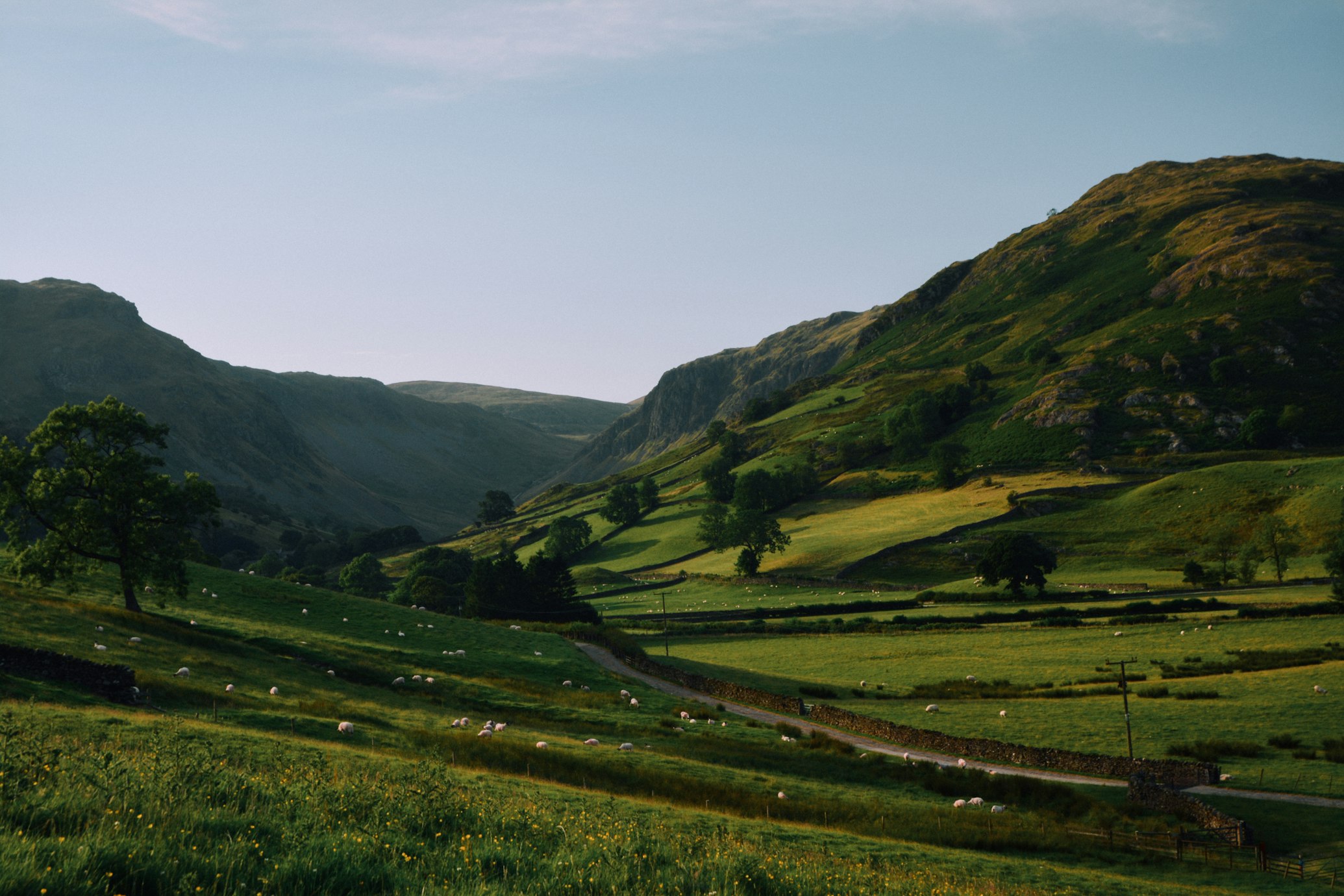
The snow pack this year was 200% of normal. The trail is hardly visible, as it's buried under several feet of snow and ice.
How remote is this wilderness? I didn't see one footprint until I was a couple of miles from a trailhead.
Unencumbered with lots of gear, I set off at 2pm on June 23.
First night

My lightweight strategy depended on finding a fire ring at a relatively low elevation so I could make a warming fire during the four darkest hours of the night. I would only use a pre-existing fire ring to conform with leave no trace principles. I would create a new fire ring only if I was getting hypothermic.
Once I left Manning Park Lodge, I started gaining altitude. I reached the USA/Canada border within 8 miles (by 6pm). The trail was surprisingly snow free until I started tackling the first of a dozen passes. Castle Pass and Hopkins Pass tested me, but the real challenge started when I came upon the Devil's Staircase.
Paradoxically, the Devil's Staircase takes you into the heavens. It reaches the highest point on the PCT in Washington: 7,100 feet. Although that's half the height of Washington's tallest mountain, Mt. Rainier, it still holds plenty of snow in late June.
I rode the crest as the sun set behind the craggy mountains, hoping to get down, find a fire ring, make a fire to keep me warm during the chilly night. However, I would have to stay on the crest for a while before dipping down. With so much snow around, I doubt I would find a fire ring at that elevation and the night would be frigid. Although I started descending by 10pm, light was rapidly fading and my tiny Photon flashlights are not designed to help you find the trail when it's under several feet of snow.
I wasted about 30 minutes going in circles, looking for the trail down. Although I could have just invented a way down, I wanted to stay close to the trail so I didn't get too far off track. Therefore, I decided to camp high on the mountain that night.
Even though snow was everywhere, there were dry patches around the fir trees. I found some big shrubs that looked cozy and crawled into one. I curled in a ball and fell asleep on my pad with my shoes on. My feet were soaked from walking in snow all day long, but they would freeze if I left them outside my boots during the night. I feel asleep quickly, knowing that my body would wake me up once I got cold. The most idiotic thing I did during this trip was that I forgot to use my space blanket during this frigid night. Doh! I have no idea why I forgot to use it.
Luckily, I slept fine. I woke up a couple of times, shifted around, and then fell back asleep. Four hours later, at 2am, I could see the horizon lighting up faintly. I was somewhat cold and I knew I needed to do some mega miles that day, so I rose to find the trail.
The warming fire

I found the signs of the trail within 10 minutes and restarted my long traverses from mountain to mountain. By 8am I had already hiked six hours nonstop when I found a fire ring. My shoes were soaked and I wanted a nap. The wood was still waterlogged with snow, but I eventually got it to burn. I curled up next to it, lay my socks near the fire, and then took a nap.
When I woke 90 minutes later I noticed that one sock was charred and the other was missing. Eventually I realized that the other sock had completely burned to a crisp.
"Well, at least I've lightened my load!" I said to myself. "And they stunk anyway."
I had two pairs of socks left.
Second night

I spent all day Saturday navigating in and out of snow. Route finding was hard, but I managed get well beyond Harts Pass and to do over 40 miles that day.
As night descended, I found myself in a familiar and challenging situation: I was on the summit of a mountain (around 6600 feet), with no sleeping bag, no shelter, and no clear trail down. I searched for 30 minutes for a way down, but with snow covering most of the mountain, it was hard to find the switchbacks that led down the mountain.
It was 9pm. I had about one hour of light left. I didn't feel like spending another night high on the mountain.
I saw spotted a ridge without snow going down a couple thousand feet to a creek where I expected the trail to be. Although the trail wasn't on this ridge, it wasn't ridiculously steep. After an hour of descending (grabbing trees the whole way down), I crossed a snow covered pass. I knew I would be cutting the trail.
A cut log! Ha! A clear sign that the trail was near. I celebrated as the darkness enveloped me.
Unfortunately, I couldn't find another sign of the trail. Therefore, I walked toward the creek, hoping that I would cross the trail again and that I would find a fire ring to sleep next to. But after 30 minutes with my Photon light, dense vegetation surrounded me.
Instead of panicking, I was happy that this thick vegetation would provide natural insulation during the night. I found a nook within the tall plants, lay down my pad, and this time remembered my space blanket! I removed my wet shoes and socks, put on dry socks, and quickly fell asleep with the sound of the roaring creek nearby.
The space blanket was amazing. It kept me so warm that I would consider doing a thru-hike with just that. I slept in: instead of waking up at 2am, I woke up at 3am. Five hours of sleep was plenty.
With a fresh and alert mind, I found the trail within 10 minutes and followed it next to the creek for several miles. I had cover the final 20 miles by 2pm to meet up with Maiu and Venkat at Rainy Pass.
Rainy Pass

The PCT didn't let me off easy. I had to overcome a series of tricky snow-filled passes before arriving to my final one: Cutthroat Pass.
I smiled as I saw Highway 20 from the top of Cutthroat Pass. Ironically, I got lost on my way down and ended up bushwhacking like crazy to arrive at the highway. Unfortunately, I ended up at least a thousand feet and a couple of miles below Rainy Pass. I had expended extra effort to go lower than I needed to go.
"Oh well, I needed to burn some more calories," I told myself.
I hitchhiked my way back up to Rainy Pass and thawed out while I waited for my friends to arrive. My 48 hour, 70 miles adventure was over. I sat back and watched the cars drive by with a happy smile on my face.