In the last three weeks I’ve walked 625 miles in New Mexico and all I’ve got to show for it are two lousy blisters.
Well, I also have stories of two nights in Silver City, two funny human encounters, and two dogs that followed me. But before sharing those, I’ll share with you my uncanny ability to lose stuff. Unfortunately, I’ve lost more than just two things.
Losing my mind
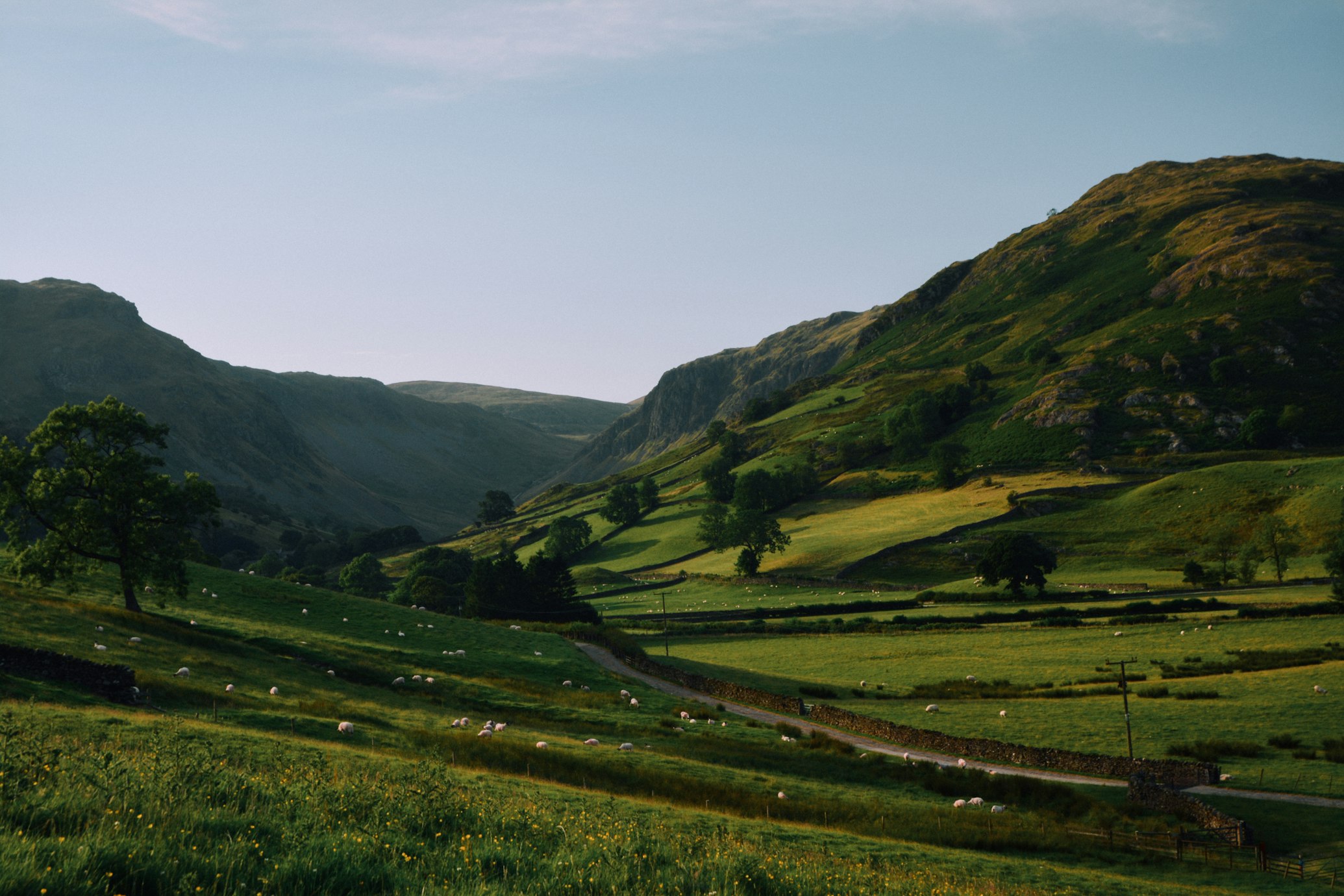
I had just left the Coyote Hills of New Mexico when I realized that I no longer had my Brunton SolarRoll. The SolarRoll is fairly large and heavy (for my standards), so it’s amazing that I managed to lose it. But I can do some amazing things…
I panicked because the SolarRoll is worth $200. I dropped my backpack and started running to try to find the SolarRoll. Then I thought, “Francis, you’re an idiot. Who the hell is going to pick up your SolarRoll? You haven’t seen anyone for a week! Sure, you see 20 rabbits a day, but I doubt they have an interest in swiping your SolarRoll.”
Nevertheless, finding the SolarRoll would be a challenge since I had blazed my own trail for most of the day. It’s not like I could just walk on a clear trail back to where I had come from. Fortunately, the ground had a clay-like consistency, so I thought I could re-trace my steps. However, I learned I’m a lousy tracker. Attention to detail is not my forte.
I gave myself half an hour to look for it in the monotonous landscape and came up empty.
As I headed back to where I had dropped off my backpack, a small herd of cows and bulls spotted me. I calculated that their trajectory would take them straight to my backpack, a quarter mile away. I was determined to cut them off before they got there so they didn’t trample it.
I started running to intercept them at an angle, but this excited the herd and they started running too – straight for my backpack.
“Francis, you’re such a total idiot. Look at yourself. You’re running parallel to a herd of cows and bulls. They’re running faster than you. You not only lost your SolarRoll, but now you’re going to get your backpack trampled to smithereens. You suck.”
Realizing that I couldn’t outrun them, I gave up and started walking, hoping they would calm down too. They did. What’s more is that on my way back I found my SolarRoll! The cows veered away from my backpack and so the story has a happy ending!
Sort of.![]()
I’ve still managed to lose:
- Flashlight (I lost 5 flashlights on the PCT)
- Toiletries bag (Pristine water purification, toothbrush, foot lotion, toothpaste, dental floss, and a $20 bill)
- Gloves (I found them once, running back half a mile to get them, but later lost them forever)
- Map (forcing me to cross the New Mexican desert without a map for two days)
And I’ve broken my digital camera (desert dust jammed it).
Later, I would break my SolarRoll too.
A tale of two nights in Silver City
”It was the best of times; it was the worst of times.” So begins A Tale of Two Cities by Charles Dickens. I
could use the same line for my two nights in Silver City.
First Night: It was the worst of times

Ominous storm clouds were building up all day as I walked down the Gila Mountain Range into Silver City, located in southern New Mexico. I went to the post office to pick up my new Gossamer Gear Miniposa backpack, but the postmaster said that the “overnight” packages take two nights to get to Silver City, so I would have to wait until tomorrow to pick it up.
Silver City, with its population of 10,500, is significant town by long distance trail standards. As a result, there are few places to stealth camp and the forest was miles away. Lightning cracked in the distance. Setting up my tarp would be too conspicuous, but I needed shelter. No cowboy camping tonight.
Next to the supermarket there was an automobile body shop. Although the roof was high (five meters), it seemed large enough to protect me from any precipitation. I tucked myself between a car and a low wall, roughly in the center of the roof. At 4 a.m. I woke up shivering.
My down.") sleeping bag was completely covered in snow!
sleeping bag was completely covered in snow!
I laughed. “Wouldn’t that be funny,” I mumbled to myself, “Instead of dying gloriously high in the mountains, I end up dying of hypothermia in downtown Silver City like some poor old bum.”
Down sleeping bags are useless when they’re wet, so I desperately searched for a warmer shelter. I started checking all the cars that were crammed in the body shop parking lot. Finally I found one with a broken window that was unlocked. I jumped in without looking and landed on the shattered glass. Luckily, I didn’t cut myself. I closed the door, curled in a ball, and waited until 6 a.m. to have breakfast at a restaurant. It was a rough and ignoble night.
It was the worst of times, indeed.
Second Night: It was the best of times

Snow continued to fall all day, but then turned to snow showers, and then to mushy rain. I couldn’t believe this was the mid-April weather in southern New Mexico down where the city was, not high in the mountain.
I did my errands and returned to the post office. As I waited in line I asked the people around me if they knew how to get to Bear Mountain Road, where the CDT took off. The lady behind me offered to show me where it is. Diana was an anthropology professor at the Western New Mexico University. She quickly felt sorry for me.
“The weather is normally not this bad in the middle April,” she said. “I realize that part of your journey is to spend some rough nights sleeping outside, but you’ll have plenty of time to do that over the next six months. If you want, you’re welcome to stay at my house tonight and I’ll take you to the trail in the morning.”
How could I turn down good old fashioned trail magic?
Diana had just finished doing her taxes (that’s why she was at the post office). She had a chicken in the oven and wanted to celebrate having completed the annual chore. She invited another friend over for dinner and we had an outstanding evening filled with fascinating conversation about Native Americans, New Mexican culture, and human relationships. We laughed often. I slept like a baby in a nice, toasty bed.
It was the best of times, indeed.
Two human encounters north of Silver City
First Encounter: The Jeep

The next day I struggled to find the trail. I was on a lonely dirt road, but a jeep came by and I flagged it down. There were two young ladies and a man inside.
I asked them, “How do I get on the trail that leads me to the Black Range ?”
“Oh, boy, you’re so far off!” said the female driver. “You need to go all the way back to Silver City and then…”
“No way,” I interrupted. “I’m on foot. I know the CDT is around here somewhere.”
“Don’t you have a car? What are you doing?”
“I’m walking to Canada and back.”
“Oh my god!” she exclaimed. “You’re that guy.”
“Um, what do you mean?” I asked.
“Oh my god! People have been talking about you in town! They knew you were coming through Silver City. That’s crazy that we met you!” she giggled.
That’s cute, but where is the trail? None of them knew.
So I bumbled around after they drove off to play with their rifles at a shooting
range.
Second Encounter: The man with a dream

After 20 minutes of wandering, I ran into a man in his late 50s who was quite knowledgeable about the CDT and directed me to the trail.
“I’m envious of you,” he confessed. “It’s been a dream of mine to hike the entire CDT. Someday…”
“You’re a good shape, you can do it,” I encouraged him.
“So where did you stay last night?” he asked.
“This nice lady I met at the post office invited me to stay at her house.”
“Really?! Wait. You’re telling me that you’re hiking the CDT and some random woman just invites you to stay at her house?”
“Yes.”
“Man, now I really need to hike this trail.”
The Black Range turns white or like this. Yuck!")
 or like this. Yuck!")
The Black Range in New Mexico is one of the most remote parts of the CDT. And it wasn’t black when I saw it. In fact, the higher elevations were more white than black – white from snow. It was just a dusting, but it was pretty… and butt cold. The sharp wind cut to the bone.
I was a bit concerned about staying warm that night because my Jacks R Better sleeping bag wasn’t designed for temperatures below freezing. I was approaching Reeds Peak, the highest point of the Black Range, in the late afternoon as the thunderclouds converged on me. I was at 10,000 feet and the next 10 miles didn’t drop below 9,000. In fact, after descending Reeds Peak, I’d have to climb back up to 9,850 feet to get over Diamond Peak. I was doomed to be stuck at a high and frigid elevation. I heard a rumble and hail started to fall. I was going to freeze, I concluded.
Although Reeds Peak is a quarter mile detour off the trail, it had a lookout tower that promised stellar views. I climbed up to bag the peak. It started to snow as I reached the summit, but visibility was still pretty good. I was surprised to find a cabin at the top, but I figured it was locked. I shouted in joy when I found that it was unlocked!
The cabin was a decadent affair… by thru-hiker standards. The Reeds Lookout Cabin had:
- Four mattresses… that had stains and holes.
- A kitchen sink… that had no running water.
- A stove… that was powered by wood.
- A pantry full of food… that was mostly old food that has been there for long time.
- A bunch of magazines… that were about 20 years old.
I was in ecstasy! “Woo-hoo!” I shouted.
However, I wasn’t alone. There was a dead mouse in a corner. I picked it up and threw it as far as I could in the woods. It was a crude funeral ceremony for the poor thing.
I gathered wood to fire up the woodstove and filled an enormous pot with snow to melt. I have no way of cooking on the CDT, so having a woodstove with a pantry full of food was nirvana. I opened an old can of corn and a can of beef stew, mixed it together in an ancient cast-iron saucepan. I had a heavenly dinner while the woodstove heated the humble cabin to cozy temperatures.
I expected to freeze that night, instead I was lying on a mattress in a toasty cabin. Now I know why my friends call me Mr. Magoo…
Next Update: This email got too long, so I’ll share my story of the two dogs in my next email!
Where am I? I’m leaving Ghost Ranch in Abiquiu, New Mexico. I’ll be in Chama, New Mexico ahead of schedule.
Sponsor Spotlight: Backcountry Navigator
My primary means of navigation are using my watch compass and Jonathan Ley’s CDT maps, which I printed out. However, my high-tech navigation solution is using the BackCountry Navigator software on a GPS-enabled Windows Pocket PC, powered by a Brunton Solaroll.
BackCountry Navigator is software that turns your Pocket PC into a capable outdoor navigation device. It can download freely available US topo maps and aerial photos. You can see your location on a moving map. Download and import waypoints, or add your own to get real-time guidance to an outdoor destination.
BackCountry Navigator is appropriate for all activities for which you would normally use a topographic map and compass or GPS. People have used it successfully in geocaching excursions, extended backpacking trips, kayak touring, and more.
For more info, visit: http://www.backcountrynavigator.com